Sea to Sky Highway: Best Scenic Stops (Vancouver to Whistler)
A stop-by-stop guide to the drive itself: what each viewpoint and waterfall is, how long to budget, where to park and how hard the walk is, from Horseshoe Bay to Whistler.
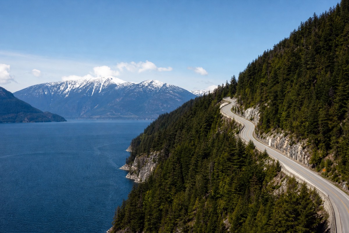
Highway 99 between Vancouver and Whistler is often called one of the most beautiful stretches of road in Canada, and the reason is simple: it runs the seam where Howe Sound meets the Coast Mountains, so the ocean is on one side and 300-metre waterfalls are on the other. Most visitors treat it as transit and blow past the good parts. Done properly, the drive is the attraction, and the 120 kilometres hide enough short stops to fill a full day. This guide takes them in order, north from the city, with the practical details you need to actually pull over.
This is the scenic-drive companion, not the logistics one. If you mainly want to know how to get from Vancouver to Whistler, which vehicle, how long, what it costs, that is covered in our transport guide, and we will not repeat it here. What follows is where to stop and why.
Budget note: original price examples below are planning allowances, not current quotes. Compare the provider’s actual date, currency, party and included extras before relying on a figure.
Plan This Experience
Driving yourself? The GPS audio tour adds stories along Highway 99 while you choose where and how long to stop.
At a glance: Sea to Sky stops, Vancouver to Whistler
Approximate distances north of Vancouver along Highway 99. Verify current road conditions before you drive.
What are the best stops on the Sea to Sky Highway?
The essential stops, south to north are Horseshoe Bay, Britannia Beach and its mine museum, Shannon Falls, the Stawamus Chief, the Sea to Sky Gondola, Tantalus Lookout and Brandywine Falls, with the Train Wreck Trail waiting just short of Whistler. Most take fifteen minutes to an hour, and nearly all have free or cheap parking.
You could do the whole run in under two hours without stopping. You could also spend eight, and the difference is entirely in how many pull-offs you take. The table below is the planning backbone: every stop with the time to budget, the parking situation and how much walking it involves, so you can build a day around your appetite and your youngest passenger.
| Stop (south to north) | What it is | Time | Parking | Effort |
|---|---|---|---|---|
| Horseshoe Bay | Seaside village and ferry terminal | 20 to 40 min | Paid lots | Flat stroll |
| Britannia Beach | Britannia Mine Museum, a National Historic Site | 1.5 to 2 hr | Free lot | Easy, indoor and tour |
| Shannon Falls | 335 m waterfall, BC's third highest | 20 to 40 min | Free provincial lot | Short flat walk |
| Stawamus Chief | Granite monolith, famous hike and climb | 10 min to 4 hr | Shared free lot | Steep if you climb |
| Sea to Sky Gondola | Cable car to a ridge with a suspension bridge | 1.5 to 3 hr | Paid lot | Easy up top, ticketed |
| Tantalus Lookout | Roadside viewpoint of the Tantalus Range | 10 to 15 min | Free pull-off | Step out of the car |
| Brandywine Falls | 70 m free-fall in a provincial park | 20 to 30 min | Free lot | Short flat walk |
| Alexander Falls | Roadside falls in the Callaghan Valley | 15 to 25 min | Free pull-off | Short walk to platform |
| Train Wreck Trail | Boxcars and a river suspension bridge | 1 to 1.5 hr | Free lot | Flat 2 km round trip |
A useful rule: pick two anchor stops that take real time, say the mine museum and one gondola or waterfall, then treat the rest as quick pull-offs. That keeps a family from mutiny and still delivers the drive's greatest hits. Once you reach the resort, our roundup of things to do in Whistler picks up where this guide leaves off.
Horseshoe Bay: where the drive begins
Horseshoe Bay marks the start of the scenic stretch, a small seaside village wrapped around a ferry terminal about 20 km from downtown Vancouver. It is a coffee-and-a-stroll stop rather than a destination, best used to caffeinate, watch the ferries and set the tone before the mountains close in.
Just past West Vancouver, Highway 99 drops to sea level at Horseshoe Bay, and the road's character changes here. The village is compact, with a waterfront park, a handful of cafes and fish-and-chips spots, and BC Ferries boats gliding in and out of the sound. Parking is paid and can be tight when a sailing loads, so it is a fifteen to thirty minute stop for most people, enough to stretch, grab a drink and take in the first proper ocean view. From here the highway starts to climb and hug the cliffs above Howe Sound, and the scenery only builds.
To gauge the shape of the day, it helps to see how the stops space out along the 120 km. The legs below are approximate driving times in clear conditions, north from the city, so pad them for traffic, for the ferry loading at Horseshoe Bay, and for winter weather.
| Leg | Distance from Vancouver | Drive time to next stop |
|---|---|---|
| Downtown to Horseshoe Bay | about 20 km | about 20 to 30 min |
| Horseshoe Bay to Britannia Beach | about 55 km | about 30 min |
| Britannia to Shannon Falls and the Chief | about 58 km | about 5 min |
| Squamish to Tantalus Lookout | about 75 km | about 20 min |
| Tantalus to Brandywine Falls | about 109 km | about 30 min |
| Brandywine to Whistler Village | about 120 km | about 15 min |
Britannia Beach and the Britannia Mine Museum
The Britannia Mine Museum, about 55 km north of Vancouver is the drive's best rainy-day and family stop. A National Historic Site on the grounds of what was once the British Empire's largest copper mine, it offers an underground train tour, gold panning and a light-and-sound show inside the towering old mill. Budget ninety minutes to two hours.
You cannot miss it: a huge staircase-shaped mill building climbs the mountainside right beside the road at Britannia Beach. The mine opened in 1904 and once led the empire in copper output, and the museum built into its bones is genuinely good, not a token roadside stop. Hard hats go on for an underground ride by rail cart into the old tunnels, kids can pan for real minerals, and a show inside Mill 3 tells the site's story with projection and sound.
Because it is indoor and hands-on, it is the stop that saves a wet day, and it works across ages. Admission is ticketed, so check current pricing and hours before you commit the time. Across the road, a small cluster of shops, a bakery and an ice cream parlour make an easy pairing. This is one to slot in as a planned anchor rather than a quick pull-off.
Shannon Falls: BC's third-highest waterfall
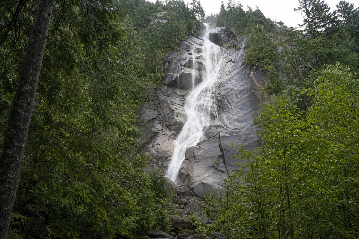
Shannon Falls plunges 335 metres down a granite cliff, the third-highest waterfall in British Columbia, and it is one of the easiest big sights on the whole highway. A flat five to ten minute walk from a free provincial parking lot brings you to the viewing area, about 58 km north of Vancouver and just south of Squamish.
For sheer payoff per step, nothing on the drive beats Shannon Falls. The provincial park sits right off Highway 99, the lot is free, and a short, mostly level path through the forest leads to viewpoints at the base, where the water fans down the rock in a long, loud cascade. It is spectacular in late spring when snowmelt is at full volume, and still impressive through summer.
Because it is so accessible, it is busy on sunny weekends, so arrive early or late for space and light. Picnic tables make it a natural lunch stop, and it shares a parking area and trails with the Stawamus Chief next door, so the two combine neatly. Twenty to forty minutes covers a relaxed visit.
Three big waterfalls punctuate this drive, and it pays to know how they differ before you decide which to stop for. Shannon is the tallest and busiest, Brandywine the most photogenic single plunge, and Alexander the quiet one most drivers pass without noticing.
| Waterfall | Height | Walk from the car | Peak flow |
|---|---|---|---|
| Shannon Falls | 335 m, third-highest in BC | 5 to 10 min, flat | Late-spring snowmelt |
| Brandywine Falls | 70 m single free-fall | about 10 min, flat | Spring and early summer |
| Alexander Falls | 43 m over three tiers | steps from the pull-off | Late spring, fewest crowds |
The Stawamus Chief
The Stawamus Chief is a 700-metre granite monolith rising straight out of Squamish, one of the largest of its kind on Earth and a magnet for climbers and hikers. You can admire it from the highway in a minute, or commit to a steep, chain-and-ladder hike to its peaks that runs three to four hours round trip.
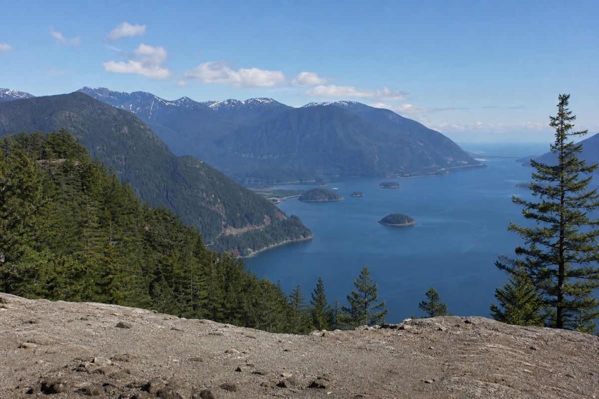
Looming over Shannon Falls, the Chief is impossible to ignore, a sheer wall of pale rock often speckled with climbers. The stop splits cleanly into two experiences. If you just want the view, pull into the shared lot, crane your neck and watch the climbers through binoculars, a ten-minute affair. If you want the hike, the trail to the First, Second and Third Peaks is a serious workout, gaining steep ground with the aid of chains and ladders near the top, and rewarding you with a huge view over Howe Sound and Squamish.
Only take on the hike if your group is up for a genuine climb and you have half a day and proper footwear. Families with young children should stick to the viewpoint and save their legs for gentler stops up the road.
Sea to Sky Gondola in Squamish
The Sea to Sky Gondola lifts you 885 metres above Squamish to a ridge with a suspension bridge, viewing decks and easy walking loops. A return ticket runs around CA$74, so check the live listing, and the visit fits comfortably into ninety minutes to three hours depending on how far you wander up top.
If you want an alpine view without a climb, this is the stop. The gondola rises from near the base of the Chief to a summit lodge, where the Sky Pilot Suspension Bridge, cantilevered viewing platforms and a network of interpretive trails open a sweeping panorama over Howe Sound, the Chief and the surrounding peaks. The walking up top ranges from a flat loop to longer hikes, so families and casual visitors get plenty without effort.
It is a paid attraction, and it invites a comparison many travellers make: how does it stack up against Whistler's Peak 2 Peak Gondola. The short answer is that this one is about the ocean-and-summit view over Squamish, while the Peak 2 Peak is about the crossing between two ski mountains. Our side-by-side on the two Sea to Sky gondolas walks through which suits your day. If you are moving with purpose, you can skip this and see the alpine at Whistler instead, but on an unhurried drive it is a highlight.
Cost is the other planning axis, and it sorts cleanly. Most of the drive's stops are free, with only two charging admission, so you can build a rich day around a single ticket when the budget is tight.
| Stop | Entry | Parking |
|---|---|---|
| Shannon Falls, Brandywine, Tantalus, Alexander Falls | Free | Free |
| Train Wreck Trail | Free | Free |
| Stawamus Chief, view or hike | Free | Free, shared lot |
| Britannia Mine Museum | Ticketed, check the live listing | Free |
| Sea to Sky Gondola | around CA$74 return, check the live listing | Paid |
Tantalus Lookout
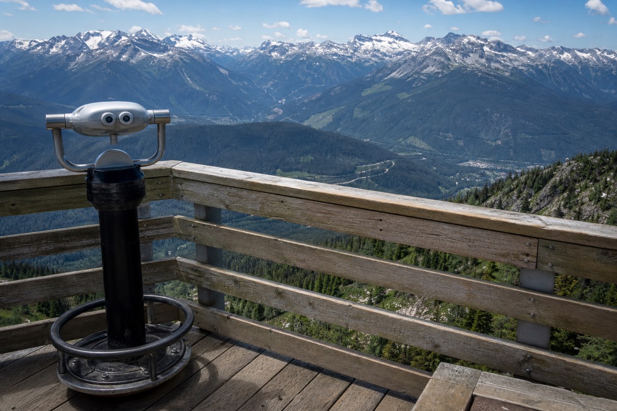
Tantalus Lookout is the classic roadside pull-off north of Squamish, a paved viewpoint framing the glaciated peaks of the Tantalus Range across the Squamish River valley. It costs nothing, needs no walking, and takes ten to fifteen minutes, which makes it the drive's best effort-to-reward ratio.
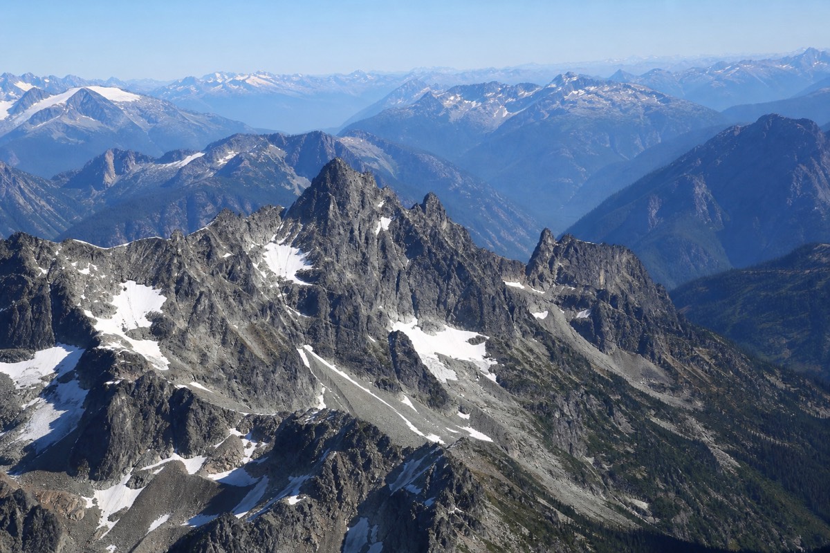
Some of the highway's finest views ask nothing of you, and Tantalus Lookout is the prime example. The pull-off has parking and interpretive signs, and the panorama takes in the jagged, glacier-draped Tantalus Range, a wall of peaks that stays snow-flecked into summer. It is a stretch-your-legs, take-the-photo, back-in-the-car stop, ideal for keeping momentum on a day already full of longer visits. Morning light tends to be kindest here.
Brandywine Falls
Brandywine Falls drops 70 metres in a single clean free-fall into a forested canyon, reached by a flat ten-minute walk from a free provincial lot about 11 km south of Whistler. A railed platform delivers a head-on view, making it one of the easiest and most photogenic stops near the resort.
Closing in on Whistler, Brandywine Falls is the last great waterfall of the drive and one of the most satisfying. The short, level trail from the parking area crosses the rail line and leads to a viewing platform that looks straight across at the plunge, with the Coast Mountains and Daisy Lake filling the background. The name comes from a surveyors' wager over the falls' height, settled, the story goes, with a bottle of brandy.
Because it is close to the resort and simple to reach, it makes an easy first or last stop of a Whistler trip, and it turns up in our list of free things to do in Whistler. Twenty to thirty minutes is plenty, and the platform suits every age and mobility level.
Alexander Falls and the Callaghan Valley
Alexander Falls is a tall, three-tiered waterfall in the Callaghan Valley, a short detour west off Highway 99 near Whistler Olympic Park. A viewing platform sits steps from the roadside pull-off, so it takes fifteen to twenty-five minutes, and it draws a fraction of the crowds that Shannon and Brandywine pull.
For a quieter alternative, turn up the Callaghan Valley Road just south of Whistler. Alexander Falls tumbles 43 metres over three tiers beside the road, viewable from a platform a few steps from a free pull-off, with the forested valley and, higher up, the Nordic venues of the 2010 Games as a backdrop. The valley itself rewards a longer detour if you have time, with trails and the Olympic Park, but the falls alone justify the short drive off the highway. It is the kind of stop that makes the drive feel like discovery rather than a checklist.
The Train Wreck Trail near Whistler
The Train Wreck Trail is the drive's quirkiest finale: a flat 2 km round-trip walk in Cheakamus, 10 to 15 minutes south of Whistler, leading over a river suspension bridge to a scatter of graffiti-covered boxcars left from a 1950s derailment. Parking is free, and the whole loop takes about an hour.
Right before the resort, this short trail packs in more character than its length suggests. From the free lots at Cheakamus Crossing, the path runs a kilometre through forest to a suspension bridge over the Cheakamus River, built in 2016, then reaches the wrecked rail cars just beyond. Decades of street artists have turned them into a rotating outdoor gallery, and the setting, forest, river and rusting steel is genuinely striking. It is flat and family-friendly, though the lots fill fast on summer weekends, so time it early or late. As a last stop before checking into Whistler, it is hard to beat.
How long should you budget, and which stops are must-do?
Driving straight through takes about two hours. A proper scenic day runs six to eight. If you only have time for a few, prioritise Shannon Falls, Brandywine Falls and one big-ticket stop like the mine museum or a gondola, then fill gaps with quick roadside viewpoints. The must-do versus optional split below sorts them.
The honest planning question is not which stops are good, they nearly all are, but which fit your clock. The table separates the stops that reward a real pause from the ones you can add if the day cooperates, so you can trim without regret.
| Priority | Stops | Why |
|---|---|---|
| Must-do | Shannon Falls, Brandywine Falls, Tantalus Lookout | Huge payoff, minimal time, free and easy |
| Worth the time | Britannia Mine Museum, Sea to Sky Gondola | Anchor stops, ticketed, an hour or more each |
| If you can | Stawamus Chief hike, Alexander Falls, Train Wreck Trail | Great but add real time or effort |
Time is one filter, but the right stops also depend on who is in the car. This quick matrix points each kind of traveller to the stops that pay off most, and the ones they can let slide.
| If you are... | Don't miss | Can skip |
|---|---|---|
| Short on time | Shannon Falls, Tantalus Lookout | The Chief hike, the mine museum |
| With young kids | Britannia Mine Museum, Train Wreck Trail | The Stawamus Chief climb |
| Keen hikers | The Stawamus Chief, Sea to Sky Gondola trails | Roadside-only pull-offs |
| Chasing photos | Tantalus Lookout, Brandywine Falls | Indoor stops on a clear day |
Many travellers do this drive as a round trip in a day. If that is your plan, our take on whether the Vancouver to Whistler drive is worth it lays out the case, and the day-trip guide sets a workable schedule.
When should you drive it, and what changes by season?
Late spring brings the loudest waterfalls from snowmelt, summer gives the longest days and warmest stops, fall trades crowds for colour, and winter can mean snow, ice and closures on the higher trails. Always check road conditions before you set off, because weather on this stretch shifts fast.
The drive is beautiful year-round, but the details change. May and June are peak waterfall season, when Shannon and Brandywine run at full force. July and August offer the longest daylight and the warmest, busiest stops, so start early to beat the parking crunch. September and October bring quiet and, up in the Callaghan, autumn colour. Winter turns the road serious, with snow and ice possible and some trails and viewpoints closed or unsafe, though the coastal scenery under snow is stunning.
| Season | What stands out | Watch for |
|---|---|---|
| Spring | Waterfalls at maximum flow | Some trails still snowy up high |
| Summer | Long days, every stop open, warm | Full lots, arrive early or late |
| Fall | Fewer people, larch and leaf colour | Shorter days, lakes and lifts winding down |
| Winter | Snow-draped coast and peaks | Ice, closures, check conditions before driving |
Whatever the month, look up current road conditions with DriveBC before leaving, since crashes, weather and construction can add hours to this route. Drive it with time to spare, and the Sea to Sky delivers the best road day in the province. For the quieter corners beyond these headline stops, our Whistler hidden gems are the follow-up.
The tours mentioned throughout this guide are run by the operators we work with at Whistler BC Tours.